
AskSia

Question
US History
Posted about 2 years ago
Examine the image and answer the question below.
New
Hampshire
New
York
Massachusetts
Rhode Island
Pennsylvania
Connecticut
New Jersey
N
Delaware
Virginia
Maryland
W
E
North
S
Carolina
South
Carolina
Georgia
Key
Settled area
British territory
Indigenous territory
Proclamation of 1763 line
The map most directly depicts the ways in which the British government
attempted to do which of the following?
Choose 1 answer:
improve trade relationships with the colonists
A
restrict the eastward expansion of indigenous people
B
C
limit the westward expansion of British colonial settlement
remove indigenous nations from North America
D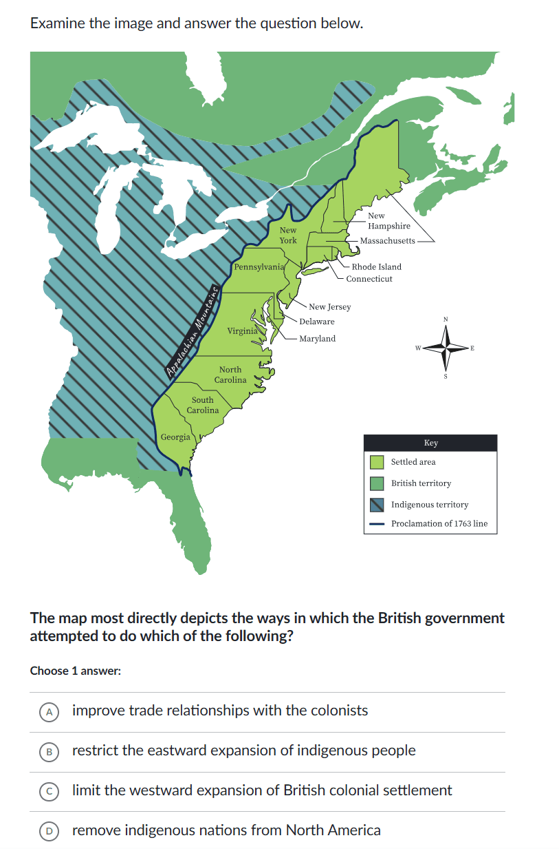
 Sign in to unlock the answer
Answer from Sia
Posted about 2 years ago
Answer
The map most directly depicts the ways in which the British government attempted to limit the westward expansion of British colonial settlement. This is evidenced by the "Proclamation of 1763 line," which was established to prevent colonists from moving westward into Indigenous territory.
Key Concept
The Proclamation of 1763 was issued by the British government to stabilize relations with Native Americans through the regulation of trade, settlement, and land purchases on the western frontier. (KC-3.1.II.B)
Explanation
The Proclamation of 1763 was a response to the growing tensions between British colonists and Native American tribes. By restricting colonial expansion west of the Appalachian Mountains, the British aimed to reduce conflicts and manage colonial growth more effectively.
Not the question you are looking for? Ask here!
Enter question by text
Enter question by image

Unlock Smarter Learning with AskSia Super!
Join Super, our all-in-one AI solution that can greatly improve your learning efficiency.
30% higher accuracy than GPT-4o
Entire learning journey support
The most student-friendly features

Study Other Question